


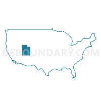
Weber County (West)--Roy, North Ogden, Ogden (Northwest) & West Haven Cities PUMA, Utah
About
Outline
--Roy%2c+North+Ogden%2c+Ogden+(Northwest)+%26+West+Haven+Cities+PUMA%2c+Utah_A280.png)
Summary
| Unique Area Identifier | 194242 |
| Name | Weber County (West)--Roy, North Ogden, Ogden (Northwest) & West Haven Cities PUMA |
| State | Utah |
| Area (square miles) | 269.45 |
| Land Area (square miles) | 190.32 |
| Water Area (square miles) | 79.13 |
| % of Land Area | 70.63 |
| % of Water Area | 29.37 |
| Latitude of the Internal Point | 41.23444590 |
| Longtitude of the Internal Point | -112.18853150 |
Maps
--Roy%2c+North+Ogden%2c+Ogden+(Northwest)+%26+West+Haven+Cities+PUMA in Utah.png)
Graphs
Select a template below for downloading or customizing gragh for Weber County (West)--Roy, North Ogden, Ogden (Northwest) & West Haven Cities PUMA, Utah
--Roy%2c+North+Ogden%2c+Ogden+(Northwest)+%26+West+Haven+Cities+PUMA%2c+Utah_T0.png)
--Roy%2c+North+Ogden%2c+Ogden+(Northwest)+%26+West+Haven+Cities+PUMA%2c+Utah_T1.png)
--Roy%2c+North+Ogden%2c+Ogden+(Northwest)+%26+West+Haven+Cities+PUMA%2c+Utah_T2.png)
--Roy%2c+North+Ogden%2c+Ogden+(Northwest)+%26+West+Haven+Cities+PUMA%2c+Utah_T3.png)
--Roy%2c+North+Ogden%2c+Ogden+(Northwest)+%26+West+Haven+Cities+PUMA%2c+Utah_T4.png)
--Roy%2c+North+Ogden%2c+Ogden+(Northwest)+%26+West+Haven+Cities+PUMA%2c+Utah_T5.png)
--Roy%2c+North+Ogden%2c+Ogden+(Northwest)+%26+West+Haven+Cities+PUMA%2c+Utah_T6.png)
--Roy%2c+North+Ogden%2c+Ogden+(Northwest)+%26+West+Haven+Cities+PUMA%2c+Utah_T7.png)
--Roy%2c+North+Ogden%2c+Ogden+(Northwest)+%26+West+Haven+Cities+PUMA%2c+Utah.png)
Neighbors
Neighoring Public Use Microdata Area (by Name) Neighboring Public Use Microdata Area on the Map
- Davis County (North)--Layton, Clearfield, Kaysville, Syracuse & Clinton Cities PUMA, UT
- Tooele & Box Elder Counties PUMA, UT
- Weber County (East)--Ogden (Southeast) & South Ogden Cities PUMA, UT
Top 10 Neighboring County (by Population) Neighboring County on the Map
- Davis County, UT (306,479)
- Weber County, UT (231,236)
- Tooele County, UT (58,218)
- Box Elder County, UT (49,975)
Top 10 Neighboring County Subdivision (by Population) Neighboring County Subdivision on the Map
- Ogden CCD, Weber County, UT (208,109)
- North Davis CCD, Davis County, UT (197,425)
- Tooele-Grantsville CCD, Tooele County, UT (54,800)
- Brigham City CCD, Box Elder County, UT (26,864)
- Northwest Weber CCD, Weber County, UT (16,523)
- Ogden Valley CCD, Weber County, UT (6,604)
- Howell-Snowville CCD, Box Elder County, UT (2,769)
- West Box Elder CCD, Box Elder County, UT (383)
Top 10 Neighboring Place (by Population) Neighboring Place on the Map
- Ogden city, UT (82,825)
- Roy city, UT (36,884)
- Clinton city, UT (20,426)
- North Ogden city, UT (17,357)
- West Haven city, UT (10,272)
- Riverdale city, UT (8,426)
- Pleasant View city, UT (7,979)
- Hooper city, UT (7,218)
- Farr West city, UT (5,928)
- Harrisville city, UT (5,567)
Top 10 Neighboring Unified School District (by Population) Neighboring Unified School District on the Map
- Davis School District, UT (306,479)
- Weber School District, UT (148,422)
- Ogden School District, UT (82,814)
- Tooele School District, UT (58,218)
- Box Elder School District, UT (49,975)
Top 10 Neighboring State Legislative District Lower Chamber (by Population) Neighboring State Legislative District Lower Chamber on the Map
- State House District 13, UT (50,040)
- State House District 6, UT (46,570)
- State House District 7, UT (35,074)
- State House District 2, UT (34,283)
- State House District 1, UT (34,122)
- State House District 12, UT (32,845)
- State House District 8, UT (32,064)
- State House District 11, UT (31,070)
- State House District 9, UT (29,905)
Top 10 Neighboring State Legislative District Upper Chamber (by Population) Neighboring State Legislative District Upper Chamber on the Map
- State Senate District 21, UT (112,079)
- State Senate District 17, UT (102,922)
- State Senate District 20, UT (97,406)
- State Senate District 19, UT (91,855)
- State Senate District 18, UT (79,560)
Top 10 Neighboring 111th Congressional District (by Population) Neighboring 111th Congressional District on the Map
Top 10 Neighboring Census Tract (by Population) Neighboring Census Tract on the Map
- Census Tract 1254.03, Davis County, UT (11,439)
- Census Tract 1254.01, Davis County, UT (11,309)
- Census Tract 1253.03, Davis County, UT (10,657)
- Census Tract 2105.06, Weber County, UT (10,379)
- Census Tract 2105.04, Weber County, UT (8,708)
- Census Tract 2103.02, Weber County, UT (7,864)
- Census Tract 2104.03, Weber County, UT (7,621)
- Census Tract 2105.05, Weber County, UT (7,369)
- Census Tract 2103.03, Weber County, UT (6,959)
- Census Tract 2101, Weber County, UT (6,942)
Top 10 Neighboring 5-Digit ZIP Code Tabulation Area (by Population) Neighboring 5-Digit ZIP Code Tabulation Area on the Map
- 84015, UT (62,494)
- 84404, UT (56,363)
- 84067, UT (37,444)
- 84401, UT (35,622)
- 84405, UT (31,348)
- 84414, UT (26,507)
- 84315, UT (7,581)
- 84310, UT (4,111)
- 84340, UT (3,369)
- 84056, UT (3,310)